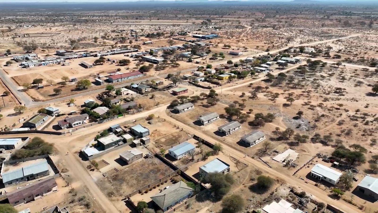
Explore the official planning maps for Mangwe District. Click any map to view it full-size, or download the high-resolution PDF.
 View full size
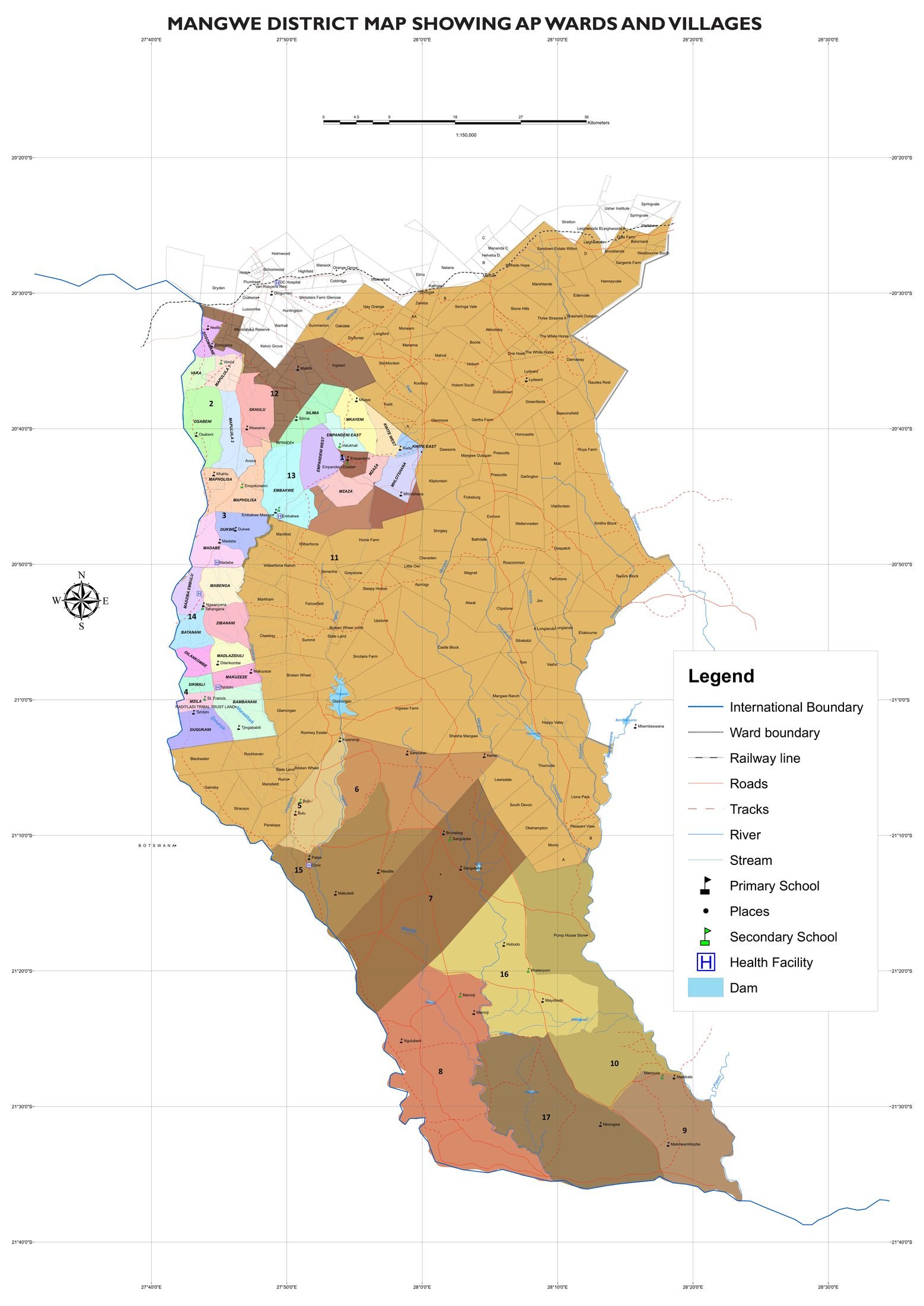
The administrative map of Mangwe District showing all 17 wards, villages, boundaries, roads, rivers, schools and health facilities.
 View full size
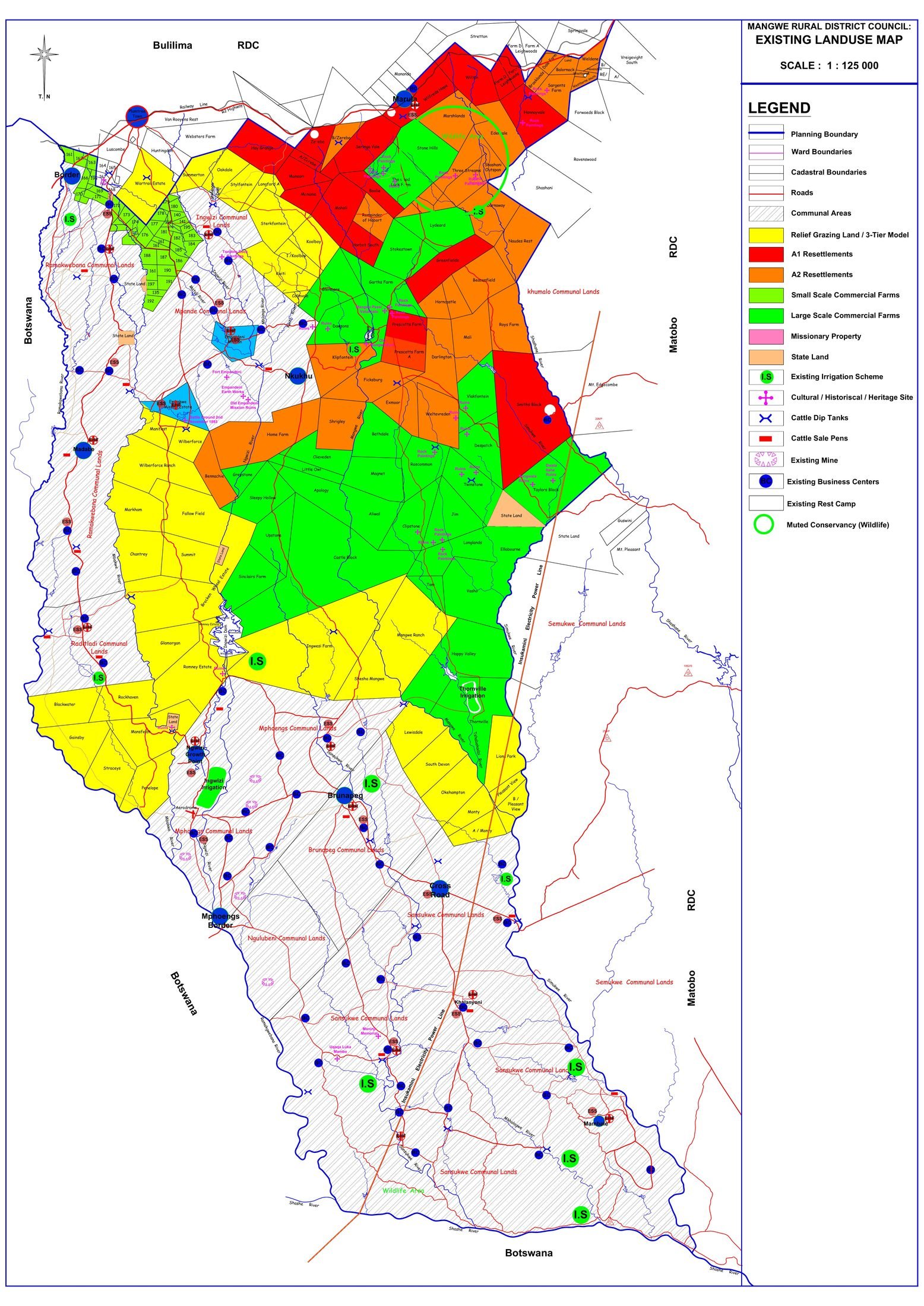
The existing land-use map covering communal areas, commercial farms, resettlements, state land, conservancies, irrigation schemes and infrastructure across the district.
 View full size
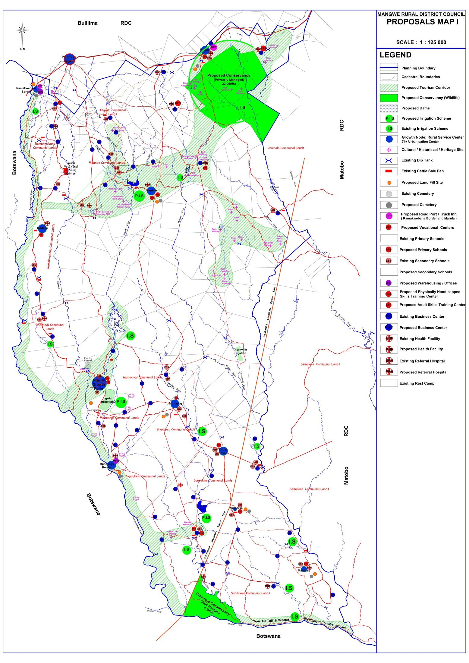
The proposals map highlighting the tourism corridor, proposed conservancies, heritage and cultural sites, dams, irrigation schemes and proposed social-service facilities.